Category:East Markham
Jump to navigation
Jump to search
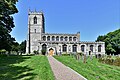
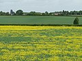
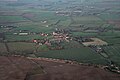
English: East Markham, historically also known as Great Markham, is a small village near Tuxford, Nottinghamshire. It lies about 8km south of Retford. It is sandwiched between the East Coast Main Line (to the east), the A1 to the west and A57 to the north.
village in Nottinghamshire, UK | |||||
| Upload media | |||||
| Instance of | |||||
|---|---|---|---|---|---|
| Location | Bassetlaw, Nottinghamshire, East Midlands, England | ||||
 | |||||
Subcategories
This category has the following 2 subcategories, out of 2 total.
C
E
- East Markham War Memorial (2 F)
Media in category "East Markham"
The following 200 files are in this category, out of 217 total.
(previous page) (next page)-
 A delight of dahlias - geograph.org.uk - 4140257.jpg 1,280 × 1,280; 475 KB
-
 A long way from home - geograph.org.uk - 4139664.jpg 1,280 × 960; 283 KB
-
-
 A1 approaching Markham Moor junction - geograph.org.uk - 4396367.jpg 640 × 428; 94 KB
-
 A1 heading north - geograph.org.uk - 4396425.jpg 640 × 428; 96 KB
-
 A1 nearing junction at Markham Moor - geograph.org.uk - 4827863.jpg 640 × 428; 81 KB
-
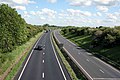
 A1 north - geograph.org.uk - 3187755.jpg 640 × 427; 80 KB
-
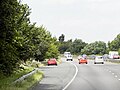
 A1 northbound - geograph.org.uk - 2688110.jpg 800 × 589; 68 KB
-
 A1 northbound - geograph.org.uk - 4827897.jpg 640 × 428; 106 KB
-
 A1 south - geograph.org.uk - 3187758.jpg 640 × 427; 69 KB
-
 A57 at Broad Gate - geograph.org.uk - 3448304.jpg 3,396 × 2,024; 3.5 MB
-
 A57 at Cliff Gate near East Markham - geograph.org.uk - 3448319.jpg 3,696 × 2,448; 2.27 MB
-
 A57 crosses the Railway - geograph.org.uk - 3448309.jpg 1,600 × 1,060; 425 KB
-
 A57 descends to Markham Moor - geograph.org.uk - 3448370.jpg 3,696 × 2,448; 2.25 MB
-
 A57 heading east - geograph.org.uk - 2688186.jpg 640 × 480; 73 KB
-
 A57 towards East Markham - geograph.org.uk - 2688957.jpg 640 × 480; 62 KB
-
 A57 towards Lincoln - geograph.org.uk - 2688182.jpg 640 × 480; 52 KB
-
 A57 towards Lincoln - geograph.org.uk - 2688184.jpg 640 × 480; 61 KB
-
 After the harvest - geograph.org.uk - 2729715.jpg 640 × 480; 92 KB
-
 Bales near Askham - geograph.org.uk - 4237541.jpg 640 × 369; 32 KB
-
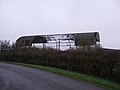
 Barn at Manor Farm - geograph.org.uk - 4140249.jpg 1,280 × 947; 258 KB
-
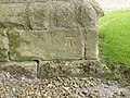
 Bench mark, Lincoln Road, East Markham - geograph.org.uk - 4139682.jpg 1,280 × 960; 486 KB
-
-
 Breck's Plantation - geograph.org.uk - 2455084.jpg 640 × 427; 74 KB
-
 Brecks Farm - geograph.org.uk - 5198208.jpg 1,024 × 768; 220 KB
-
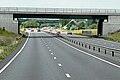
 Bridge over A1 - geograph.org.uk - 2642778.jpg 640 × 428; 96 KB
-
 Broad Gate - geograph.org.uk - 4227516.jpg 4,896 × 3,672; 6.9 MB
-
 Church Street, East Markham postbox ref NG22 151 - geograph.org.uk - 4139714.jpg 1,280 × 960; 453 KB
-
 Cleveland Hill - geograph.org.uk - 1321963.jpg 640 × 427; 76 KB
-
 Cleveland View - geograph.org.uk - 2354783.jpg 640 × 427; 114 KB
-
 Cliff Gate - geograph.org.uk - 2354868.jpg 640 × 427; 99 KB
-
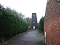
 Converted windmill - geograph.org.uk - 595945.jpg 640 × 480; 89 KB
-
 Corn Blowing in the wind - geograph.org.uk - 1321992.jpg 640 × 427; 79 KB
-
 Cottam Power Station, aerial 2013 - geograph.org.uk - 3596883.jpg 640 × 427; 39 KB
-
 Country Lane - geograph.org.uk - 1322041.jpg 640 × 427; 72 KB
-
 Country road to East Markham - geograph.org.uk - 1321987.jpg 640 × 427; 67 KB
-

-
 Countryside south of Askham - geograph.org.uk - 2351904.jpg 640 × 430; 24 KB
-
 Countryside south of East Markham - geograph.org.uk - 2351907.jpg 640 × 430; 25 KB
-
 Crops in the sun - geograph.org.uk - 1331099.jpg 640 × 427; 69 KB
-
 Crossroads, East Markham - geograph.org.uk - 4129736.jpg 1,280 × 918; 177 KB
-
 Cush Pool House - geograph.org.uk - 4139668.jpg 1,280 × 871; 264 KB
-
 Cushpool House, East Markham - geograph.org.uk - 3281792.jpg 1,024 × 768; 117 KB
-
 December Cottage, Low Street - geograph.org.uk - 4140293.jpg 1,280 × 942; 255 KB
-
 Depot on Askham Road - geograph.org.uk - 2688194.jpg 640 × 488; 54 KB
-
 East Markham - geograph.org.uk - 1322121.jpg 640 × 393; 59 KB
-
 East Markham farmland - geograph.org.uk - 2354821.jpg 640 × 427; 101 KB
-
 East Markham Hall - geograph.org.uk - 4139712.jpg 1,280 × 933; 309 KB
-
 East Markham Pinfold - geograph.org.uk - 1330450.jpg 640 × 426; 90 KB
-
 East Markham pinfold - geograph.org.uk - 4139701.jpg 1,280 × 960; 373 KB
-
 East Markham playing fields - geograph.org.uk - 4140255.jpg 1,280 × 914; 308 KB
-
 East Markham Primary School - geograph.org.uk - 4129708.jpg 1,280 × 851; 161 KB
-
 East Markham view - geograph.org.uk - 789927.jpg 640 × 427; 57 KB
-
 East Markham Village Hall - geograph.org.uk - 4139688.jpg 1,280 × 960; 360 KB
-
 East Markham Village Hall - geograph.org.uk - 785759.jpg 640 × 330; 60 KB
-
 East Markham village sign - geograph.org.uk - 4129717.jpg 1,280 × 960; 235 KB
-
 East Markham, Church Street - geograph.org.uk - 6236710.jpg 6,482 × 4,321; 5.01 MB
-
 East Markham, St. John the Baptist Church, Southern aspect - geograph.org.uk - 6285051.jpg 5,917 × 3,945; 4.87 MB
-
 East Markhan, St. John the Baptist Church, south porch - geograph.org.uk - 6329578.jpg 5,749 × 3,832; 6.5 MB
-
 East Meadow Road - geograph.org.uk - 2354953.jpg 640 × 427; 161 KB
-
 East Meadow Road - geograph.org.uk - 2355320.jpg 640 × 427; 99 KB
-
 End of the road - geograph.org.uk - 1322080.jpg 640 × 427; 80 KB
-
 Entering East Markham - geograph.org.uk - 3281759.jpg 1,024 × 768; 136 KB
-
 Entrance to Kingshaugh Farm - geograph.org.uk - 5198316.jpg 1,024 × 768; 246 KB
-
 Farm building at Woodward Farm - geograph.org.uk - 4140265.jpg 1,280 × 907; 470 KB
-
 Farm buildings at Pond Farm - geograph.org.uk - 4139672.jpg 1,280 × 930; 353 KB
-
 Farm Lane, East Markham - geograph.org.uk - 4140297.jpg 1,280 × 861; 212 KB
-
 Farmland between two windmills - geograph.org.uk - 3514240.jpg 1,024 × 768; 268 KB
-
 Farmland near Askham - geograph.org.uk - 2659003.jpg 1,600 × 1,200; 296 KB
-
 Farmland Near Askham - geograph.org.uk - 4237539.jpg 640 × 462; 35 KB
-
 Farmland near East Markham - geograph.org.uk - 2405711.jpg 640 × 355; 33 KB
-
 Farmland near East Markham - geograph.org.uk - 2659012.jpg 800 × 542; 62 KB
-
 Farmland off Broad Gate (A57) - geograph.org.uk - 2688956.jpg 640 × 480; 73 KB
-
 Farmland off Holme Lane - geograph.org.uk - 2688105.jpg 800 × 600; 83 KB
-
 Farmland off the A57 - geograph.org.uk - 2688181.jpg 640 × 480; 64 KB
-
 Farmland off the B1164 - geograph.org.uk - 2691287.jpg 640 × 468; 52 KB
-
 Farmland south of Askham - geograph.org.uk - 2659006.jpg 1,600 × 1,049; 236 KB
-
 Farmland, East Markham - geograph.org.uk - 4237534.jpg 640 × 430; 32 KB
-
 Field - geograph.org.uk - 5674920.jpg 6,032 × 4,014; 4.25 MB
-
 Field boundary off Old Moorgate - geograph.org.uk - 5198282.jpg 1,024 × 730; 170 KB
-
 Field of oilseed rape - geograph.org.uk - 5198302.jpg 1,024 × 768; 192 KB
-
 Field of oilseed rape - geograph.org.uk - 5198327.jpg 1,024 × 768; 160 KB
-
 Field of oilseed rape beside Broad Gate (A57) - geograph.org.uk - 5198311.jpg 1,024 × 768; 279 KB
-
 Fields south of East Markham - geograph.org.uk - 3272790.jpg 2,592 × 1,944; 1.55 MB
-
 Fields towards Askham - geograph.org.uk - 3455139.jpg 2,808 × 1,672; 1.67 MB
-
 Fingerpost, Mark Lane-Tuxford Road, East Markham - geograph.org.uk - 4129731.jpg 960 × 1,280; 267 KB
-
 Fingerpost, West Markham - geograph.org.uk - 4128439.jpg 1,280 × 960; 193 KB
-
 Font and Organ, St John the Baptist church, East Markham - geograph.org.uk - 4745638.jpg 2,848 × 4,272; 4.35 MB
-

-
 Footbridge over the A1, Beacon Hill - geograph.org.uk - 2514616.jpg 640 × 430; 39 KB
-

-
 Footpath off the B1164 - geograph.org.uk - 2691265.jpg 640 × 480; 120 KB
-
 Former village store, East Markham - geograph.org.uk - 4139648.jpg 1,280 × 919; 184 KB
-

-
 Freightliner passing the allotments - geograph.org.uk - 4140263.jpg 1,280 × 841; 260 KB
-
 Garden ornaments for clearance - geograph.org.uk - 4129724.jpg 1,280 × 960; 234 KB
-
 Granary, Low Street, East Markham - geograph.org.uk - 3281775.jpg 1,024 × 768; 174 KB
-
 Great North Road (B1164) - geograph.org.uk - 2691290.jpg 640 × 480; 61 KB
-

-
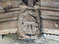 Green Man - geograph.org.uk - 4343002.jpg 1,024 × 768; 286 KB
-
 Hairdressing salon entrance and postbox - geograph.org.uk - 4139657.jpg 1,272 × 1,280; 227 KB
-
 Harold House Farm - geograph.org.uk - 2354857.jpg 640 × 427; 88 KB
-
 Harvested field near Askham - geograph.org.uk - 6274535.jpg 1,024 × 512; 119 KB
-
 Hi speed Tennis - geograph.org.uk - 785756.jpg 640 × 384; 65 KB
-
 High Brecks Farm.jpg 1,024 × 768; 185 KB
-
 High Street - geograph.org.uk - 2354832.jpg 640 × 427; 104 KB
-
 High Street - geograph.org.uk - 2354903.jpg 640 × 427; 73 KB
-
 High Street, East Markham - geograph.org.uk - 4139658.jpg 1,280 × 960; 307 KB
-
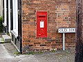 High Street, East Markham postbox ref NG22 36 - geograph.org.uk - 4139650.jpg 1,280 × 960; 433 KB
-
 Holme Lane - geograph.org.uk - 2467755.jpg 640 × 427; 76 KB
-
 Holme Lane - geograph.org.uk - 5674915.jpg 6,032 × 4,014; 6.05 MB
-
 Holme Lane towards Rockley - geograph.org.uk - 3049858.jpg 800 × 600; 93 KB
-
 Holme Lane west of Askham - geograph.org.uk - 2099735.jpg 900 × 592; 314 KB
-
 Houses on Great North Road - geograph.org.uk - 2642757.jpg 640 × 428; 88 KB
-
 Isolated tree - geograph.org.uk - 5198291.jpg 1,024 × 768; 232 KB
-
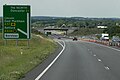
 Junction bridge, Markham Moor, A1 - geograph.org.uk - 2514624.jpg 640 × 348; 35 KB
-
 Lay-by by A57 east of East Markham - geograph.org.uk - 5996895.jpg 1,600 × 1,065; 603 KB
-
 Lay-by by A57 west of Darlton - geograph.org.uk - 5996894.jpg 1,600 × 1,196; 689 KB
-

-
 Lincoln Road, East Markham - geograph.org.uk - 4139698.jpg 1,280 × 960; 458 KB
-
 Line of trees and field of oilseed rape - geograph.org.uk - 5198297.jpg 1,024 × 768; 201 KB
-
 Looking towards Askham - geograph.org.uk - 1514236.jpg 640 × 427; 66 KB
-
 Lorries parked at Markham Moor Services, Retford - geograph.org.uk - 5749386.jpg 1,996 × 1,466; 1.19 MB
-
 Low Becks Farm - geograph.org.uk - 4227504.jpg 4,896 × 3,672; 6.38 MB
-
 Low Brecks Farm - geograph.org.uk - 2455090.jpg 640 × 427; 79 KB
-
 Mark Lane - geograph.org.uk - 789916.jpg 640 × 427; 99 KB
-
 Markham Cottage, Low Street - geograph.org.uk - 3281769.jpg 1,024 × 768; 118 KB
-
 Markham Moor Services, Retford - geograph.org.uk - 5749384.jpg 1,972 × 1,430; 1.14 MB
-
 Markham Moor Services, Retford - geograph.org.uk - 5755626.jpg 1,862 × 964; 738 KB
-
 McDonald's - geograph.org.uk - 3187762.jpg 640 × 427; 97 KB
-
 McDonald's at Markham Moor Services, Retford - geograph.org.uk - 5750449.jpg 1,990 × 1,454; 1.25 MB
-
 Mill Field Cottages - geograph.org.uk - 2691279.jpg 640 × 480; 56 KB
-
 Mussel and Crab Restaurant - geograph.org.uk - 2691261.jpg 640 × 480; 51 KB
-
 Nice evening for a drink - geograph.org.uk - 1322110.jpg 640 × 427; 73 KB
-
 Northbound A1 - geograph.org.uk - 4918979.jpg 640 × 427; 322 KB
-
-
 Northbound A1 near to West Markham - geograph.org.uk - 4918976.jpg 640 × 427; 326 KB
-

-
-
 Northbound A1, Layby near to Tuxford - geograph.org.uk - 4922765.jpg 640 × 480; 362 KB
-
 Norwood Cottage, Church Street - geograph.org.uk - 4140285.jpg 1,280 × 964; 317 KB
-
 Norwood Cottage, East Markham - geograph.org.uk - 3281785.jpg 1,024 × 768; 212 KB
-
 Oil seed rape field, north of Tuxford Windmill - geograph.org.uk - 3514236.jpg 1,024 × 614; 125 KB
-
 Oilseed rape and Brecks Plantation - geograph.org.uk - 5198320.jpg 1,024 × 768; 233 KB
-

-

-
 Old Moorgate - geograph.org.uk - 2354911.jpg 640 × 427; 94 KB
-
 Old Moorgate - geograph.org.uk - 2354917.jpg 640 × 427; 103 KB
-
 Old Moorgate - geograph.org.uk - 2354945.jpg 640 × 427; 92 KB
-
 Old Moorgate - geograph.org.uk - 2354947.jpg 640 × 427; 106 KB
-
 Old Moorgate - geograph.org.uk - 2355322.jpg 640 × 427; 108 KB
-
 Old Moorgate - geograph.org.uk - 5198214.jpg 1,024 × 768; 215 KB
-
 Old Moorgate - geograph.org.uk - 5198242.jpg 1,024 × 768; 199 KB
-
 Old Moorgate - geograph.org.uk - 5198266.jpg 1,024 × 768; 179 KB
-
 Old Moorgate - geograph.org.uk - 5198270.jpg 1,024 × 768; 216 KB
-
 Old Moorgate - geograph.org.uk - 5198286.jpg 1,024 × 768; 345 KB
-
 Orchard off Old Moorgate - geograph.org.uk - 5198264.jpg 1,024 × 768; 343 KB
-
 Overbridge, Markham Moor, A1 - geograph.org.uk - 3196064.jpg 640 × 430; 36 KB
-
 Parish boundary - geograph.org.uk - 2355297.jpg 640 × 427; 79 KB
-
 Petrol pumps at Markham Moor Services, Retford - geograph.org.uk - 5752482.jpg 2,048 × 1,536; 1.85 MB
-
 Pigeoncote at Bowerhayes, East Markham - geograph.org.uk - 4139706.jpg 1,280 × 960; 429 KB
-
 Pigeoncote at Woodward Farm - geograph.org.uk - 4140282.jpg 1,031 × 1,280; 339 KB
-
 Pond Farmhouse - geograph.org.uk - 4139679.jpg 1,280 × 960; 263 KB
-
 Porch roof - geograph.org.uk - 4342993.jpg 1,024 × 768; 294 KB
-
 Priestgate Overbridge, A1 - geograph.org.uk - 2514609.jpg 640 × 430; 36 KB
-
 Priestgate towards East Markham - geograph.org.uk - 2691283.jpg 640 × 480; 52 KB
-
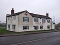
 Queen's Hotel - geograph.org.uk - 2354899.jpg 640 × 427; 79 KB
-
 Queens Hotel - East Markham - geograph.org.uk - 126046.jpg 640 × 480; 80 KB
-
 Railway bridge over Askham Road - geograph.org.uk - 2688188.jpg 640 × 480; 80 KB
-
 Railway Farm, East Markham - geograph.org.uk - 4140253.jpg 1,280 × 938; 301 KB
-
 Restored village pump, East Markham - geograph.org.uk - 4129726.jpg 960 × 1,280; 348 KB
-
 Ruined barn off Holme Lane - geograph.org.uk - 2688104.jpg 800 × 600; 72 KB
-
 Shade on a hot afternoon - geograph.org.uk - 973222.jpg 640 × 427; 76 KB
-
 Signs on Church Street - geograph.org.uk - 4140284.jpg 1,280 × 960; 624 KB
-

-

-
 Telephone kiosk and notice board, East Markham - geograph.org.uk - 4139662.jpg 1,280 × 960; 372 KB
-
 The A1 looking towards Markham Moor - geograph.org.uk - 1322009.jpg 640 × 427; 73 KB
-
 The A1 south of Markham Moor - geograph.org.uk - 1322001.jpg 640 × 427; 73 KB
-
 The A57 looking towards Lincoln - geograph.org.uk - 2730205.jpg 640 × 427; 55 KB
-
 The churchyard, East Markham - geograph.org.uk - 3281783.jpg 1,024 × 768; 171 KB
-
 The Countryside nr East Markham - geograph.org.uk - 1322101.jpg 640 × 427; 83 KB
-
 The Crown - geograph.org.uk - 2354790.jpg 640 × 427; 69 KB
-
 The Crown Pub and eating house - geograph.org.uk - 1322117.jpg 640 × 427; 62 KB
-
 The end of the line - geograph.org.uk - 5071527.jpg 1,024 × 768; 158 KB
-
 The former Crown Inn - geograph.org.uk - 4139660.jpg 1,280 × 960; 165 KB
-
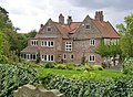 The Manor, East Markham - geograph.org.uk - 4139912.jpg 1,280 × 937; 453 KB
-
 The Mussel ^ Crab - geograph.org.uk - 3187777.jpg 640 × 427; 67 KB
-
 The site of Pond House - geograph.org.uk - 4139693.jpg 1,280 × 960; 345 KB
-
 The Windmill on Priestgate - geograph.org.uk - 2691274.jpg 640 × 480; 76 KB
-
 Tower Farm - geograph.org.uk - 6299308.jpg 4,954 × 3,444; 3.39 MB
-
 Train passing Askham, aerial 2017 - geograph.org.uk - 5626494.jpg 800 × 533; 72 KB
-
 Tuxford Road - geograph.org.uk - 4745041.jpg 1,600 × 1,067; 233 KB
-
 Tuxford Road - geograph.org.uk - 789941.jpg 640 × 427; 64 KB
-

-
 View from A1 - geograph.org.uk - 5631489.jpg 640 × 480; 47 KB
-
 View from Mark Lane - geograph.org.uk - 789923.jpg 640 × 427; 100 KB
-
-
 View to East Markham - geograph.org.uk - 789948.jpg 640 × 427; 59 KB
-
 View towards East Markham - geograph.org.uk - 3309650.jpg 1,024 × 768; 50 KB


_-_geograph.org.uk_-_2688956.jpg)


_-_geograph.org.uk_-_5198311.jpg)


_-_geograph.org.uk_-_2691290.jpg)
_heading_south_-_geograph.org.uk_-_2691268.jpg)


